Showing posts with label Ghana Mountaineers. Show all posts

Wednesday, 21 August 2013

Ghana


Two years goes quickly. It feels like only yesterday that Hannah and I landed at Kotoka airport in Accra, late in the night, wondering what life in Ghana would be like.

It wasn’t yesterday, of course; yesterday I was sipping a coffee in a trendy Berlin café, just around the corner from our new flat. The summer air was crisp compared to

Accra’s humid cloak; the pavement consisted of neatly arranged slabs, rather than an open sewer; the waitress came straight over to serve me, without having to be prodded awake first.

And yet I was missing Ghana. Berlin seems too calm, too organised. I miss the chaos: hawkers coming up to sell bead necklaces and phone credit; goats eating plastic bags and chickens pecking for seeds; the constant sounds of car horns and music; children playing in the streets; everyone smiling, whatever they’re doing.

Ghana was a wonderful home for two years. We visited a lot of the country – the geography geek in me was pleased that we spent time in all ten of Ghana’s regions – and were rewarded with some truly memorable experiences.
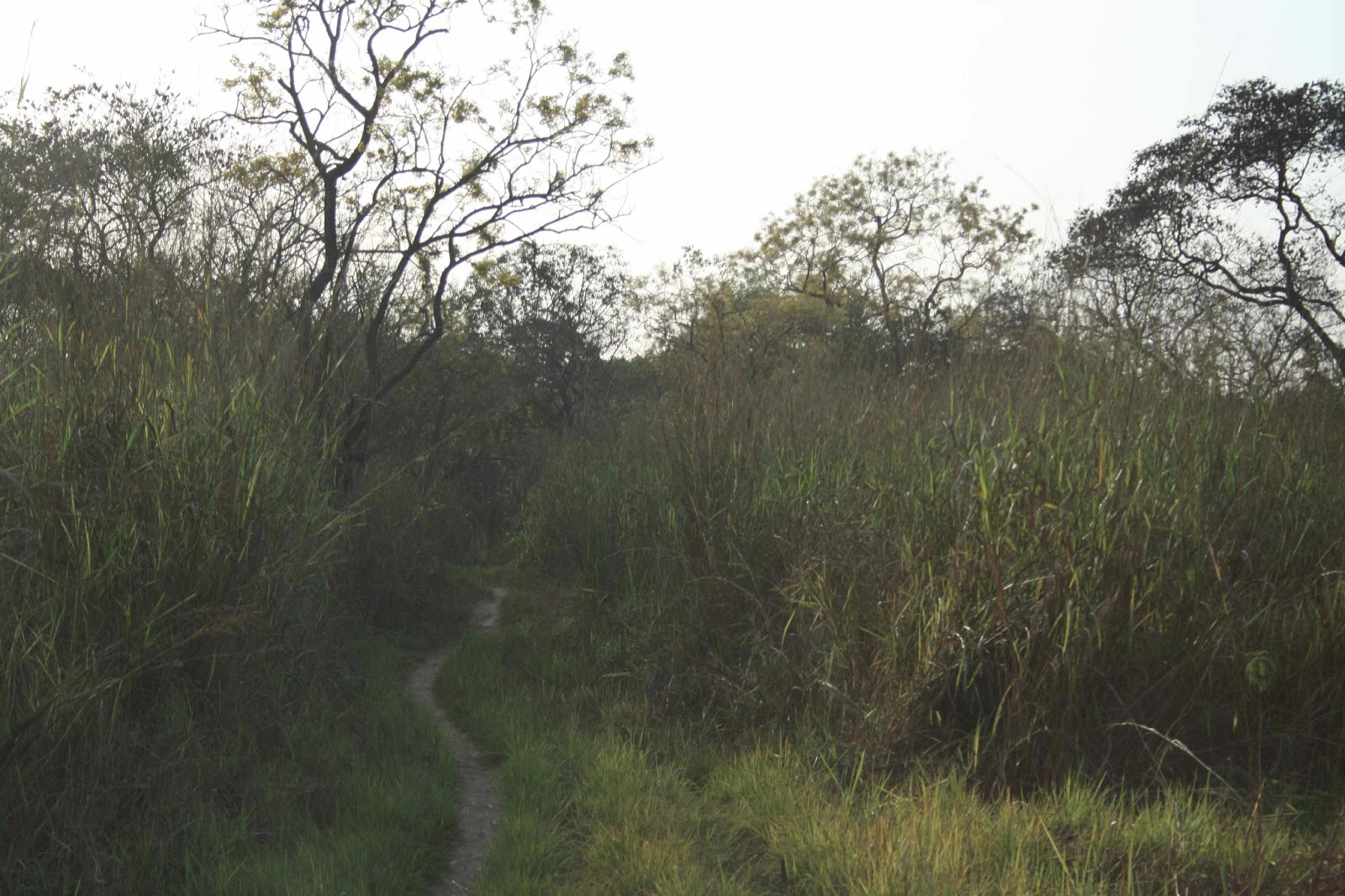
One highlight was Mole National Park, which compensates for its lack of big cats or migrating herds by getting visitors up close to its elephants. If you’ve never watched elephants mix up a mud bath before coating skin or playing together in a water hole, or had one look you directly in the eye from just a few metres away, then it’s worth visiting Ghana for this alone.

The bird walk and afternoon game drives were also rewarding. Our guides always managed to spot something special: a roan antelope through the dense bush or a colourful fruit pigeon hidden in the higher branches. Mole has plans to develop a luxury lodge, and the road from Tamale is being improved. Hopefully the park will maintain its understated charm despite these new developments.

Ghana’s main attraction is its tropical beaches. We explored much of the coast, from Beyin near the Cote D’Ivoire border to Keta Lagoon in the southeast. My favourite place was Green Turtle Lodge, a backpacker resort near Akwidaa – the perfect place to lie back in a hammock, drink beer with other travellers and wish you had thought of writing ‘The Beach’ first. Hannah’s pick was the more upmarket Fanta’s Folly near Butre, where the eponymous Nigerian owner serves delicious food flavoured with herbs picked from her husband’s garden. We also saw our one and only turtle in Ghana here. Closer to Accra, Till’s No.1 resort provided a quick weekend getaway from city life.

One of my motivations for moving to Ghana was to see the lesser-known parts of a country, something not always possible with shorter visits. The main outlet for this was the Ghana Mountaineers, a group of like-minded hikers gathered from across the world in Accra. We climbed Ghana's highest peak; we camped out under a full moon on Verandah Mountain; we completed Ghana’s own three peaks, Krobo, Iogaga and Osoduku; and we beat our own tracks through the hills of the Volta Region and beyond, literally in places: while many people visit Boti Falls, very few hack their way up the river to do it, battling snakes (OK, one sleeping snake), storms and the jungle on the route. Ghana has huge potential as a hiking destination; nothing too high or challenging, but fantastic views and a good infrastructure to get around easily.

If Ghana is easy to fall for, Accra takes a little longer to love. It’s a fast-developing city, with high-rise buildings going up on every spare corner of land, clearing the last few green spaces and trees as they go. Half-built concrete shells dominate the city’s skyline and as flats, hotels, offices and shopping malls come to life. Many of these changed little in two years, as the developers’ money runs out or they become mired in land disputes. Painted warnings claiming ‘land not for sale’ are a common sight, and anyone passing through Cantoments will see the red warnings on land: ‘Property of E.B. Tibboh – keep off’, although he never seemed to actually build anything.

Next to our flat in East Legon, an entire block of flats was constructed from scratch during our stay. As the bright orange outer panels coloured our neighbourhood and the vast satellite dishes were screwed on, the family living across the road sold simple meals of fufu and sauce to workers from the nearby repair yard and farms from their ramshackle wooden hut. The children, who worked there late into the night, sold me beer and tomato puree, insisting that I returned the bottles so they could get their deposits back. Every few pesawas counts for Accra’s poorer residents. And their simple business was a step up from those found in the poorest quarters, such as Jamestown.

Life in Accra had its moments, though. We enjoyed some fantastic food (none of it Ghanaian) in the capital’s many restaurants; I played football with former Ghana internationals at the British High Commission, and we watched the local derby, Hearts of Oak v Asante Kotoka, in the impressive national stadium; Hannah taught a former president’s grandson at Ghana International School; and on an unforgettable night at +233 jazz club, we joined our Canadian friends Andrew and Christie as part of a mass dance routine without being laughed off the floor by the more supple and rhythmic locals.

We also experienced an African election. After the build up, which saw the unexpected and widely mourned death of the president John Atta Mills, I had anticipated … what? Street riots? Tribal warfare? Perceptions of African democracy are probably tainted by those that make the news in the UK. But in the event, it was extremely quiet and democratic; there was more tension in the city during the two African Cup of Nations, in both of which Ghana made the semis. And lost.

There are many more memories: the primary school on Kpala island in Lake Volta powered by the playground roundabout; visiting the rice farmers in the Volta Region and hearing about the complexities of land acquisitions; experiencing the shrines and rituals of northern Ghana. Two years was long enough to enjoy the good things about the country, and we are leaving before the typically insignificant and indulgent expat frustrations – power cuts, heat stroke, traffic, bewilderment about the Ghanaian way of doing things –led to an even more unhealthy amount of Gulder beer being consumed.  

Hannah and I are both certain that we will return to Ghana, to visit friends, return to Mole and laze on the beach. But for now, as with half of the dishes listed on any Ghanaian menu … please, it is finished.

Sunday, 26 May 2013

Afadjato


Mount Afadjato. Not that huge.
Mount Afadjato is Ghana’s highest mountain, reaching 885m. But the usual nicknames given to a country’s highest point are not applied here; no one describes it as ‘the rooftop of Ghana’, for example. And as you arrive at the base at Liati Wote, it’s easy to see why: Ghana’s highest mountain is surrounded by taller ones.

On the way to the top
Even the nearest peak, just across the road in the village, looks bigger. As our group from the Ghana Mountaineers pulled on walking boots and paid our hiking fees, I asked Justice, our guide, if the nearby hill was actually in Togo, given how close we were to the border. “No, but it’s much harder to reach the top”, he replied. It seems Afadjato is not even the tallest in its village; its image was quickly becoming irredeemably tarnished.

A signpost
The answer lies in the complexities of measuring summits and descents in between high points, a familiar issue to anyone who has tried to distinguish between Munros, Corbetts and Grahams in the UK. On the route up, Justice explained that the higher peaks nearby form part of a ridge that switches between Ghana­ and Togo. So while there are higher points in Ghana, Afadjato is the highest freestanding peak.

Hot, sweaty and having just been sick
I think that’s right; Justice wasn’t entirely sure, and didn’t really seem to understand why it mattered. He had a point; a good walk is a good walk, and Afadjato is certainly that. A steep path leads up its western face, with a couple of rocky climbs that provide a nod towards its ‘mountain’ status. And the views at the summit are superb: the Agumatsa Hills, coated by a dark green forest, stretch for miles to the north and south.

Also visible from the top is Tagbo Falls and after descending the hill, we continued along the low-level path to this beautiful waterfall set in a lush forested amphitheatre. The walk up Afadjato had worked up a sweat and Stephen, Quaysie and I splashed under the water to cool off. Once refreshed, we could reflect on our earlier achievement – climbing the highest hill in Ghana that’s not partly in Togo or a bit tricky to get to. Now that’s some achievement.

Tagbo Falls

Sunday, 12 May 2013

Terrapins


The road to Krobo
The markers along the early drive to Krobo were all present and correct: stalls of bread sellers at Ashaiman; baboons lingering outside the Shai Hills; early morning joggers on the Akosombo road; the police reluctantly waving our car through their checkpoint, the diplomatic number plates meaning no ‘dash’ this time.

This was my seventh trip up Krobo and the route was equally familiar. I knew every rock along the way, despite the tall grass obscuring the path. But even well-trodden hills can throw up surprises.

Snake!
Just beyond the short rock climb, Carolyn spotted a small grey snake crossing the path. This was the first snake I had seen on Krobo, and only the third in two years in Ghana – a welcome rare sighting. The bulge midway along its length suggested we were slightly less likely to see a mouse on route. After pausing while we took its picture, it slid off to digest its meal in peace.

A baby terrapin
An even bigger surprise was waiting at the top. In among the rocks at the summit is a small pool of water, which had been recently replenished by the rain. Something bobbing near the surface caught my eye; was that really a baby terrapin? I looked again and saw another further along, and another climbing the side of the pool. As we admired them, the mother, hidden in the grass, splashed into the water and disappeared into the depths of the murky pool.

Route-finding
It’s a mystery how they got there; there’s no other standing water for a long way, and the sides of Krobo are surely too steep for a terrapin to climb (and why would they bother?) Could a bird have dropped one while flying overhead? Could there be a cave system hidden within the hill, connecting them to rivers below? It is likely to remain a mystery for quite some time.

This wasn’t just a simple stroll up Krobo, however; our group continued to Stone Lodge through the scrubby plains of lowland Ghana. We took a bearing – none of this GPS nonsense, just binoculars and a compass – and set off due south.

Krobo in the background
Aside from the occasional thicket of trees, and ditches formed by cattle that were now filled with water, the route was fairly straightforward. But 14km is a long way in the heat of Ghana; as we reached Stone Lodge three hours later, I considered the fact that most of our fellow expats would – like the Krobo terrapins – have opted for a day swimming in the pool rather than a hike in the midday sun.

Tuesday, 26 February 2013

Sierra Leone part 2: Mount Bintumani


Arriving at Sinekoro just after midday, Kevin, Miriam and I were keen to make up for the time lost driving around the farthest corners of Sierra Leone. Not so fast … things are not rushed in this part of the world.

Sinekoro
First we had to meet the chief of Sinekoro and the village elders, to ask permission to climb Mount Bintumani and hire a guide and porter. The first part was easy; we were welcomed as the first visitors that year, the River Seli having only just dropped sufficiently to allow cars through. The second part not so: “They are all off in their fields; you will have to go tomorrow”. 

On the way
 This was not an attractive proposition in a village without any obvious supply of beer. Fortunately Alusine, our driver, once again came to the rescue. After a long discussion in Krio that involved most of the village and a lot of pointing, it was agreed that Hassan and Moses, two teenagers, would take us and we could leave straight away. We repacked our bags, watched by a crowd of excitable schoolchildren, and set off towards Bintumani.

Shortly after leaving the village and its farms we reached the rain forest that covers much of the Loma Mountains, of which Bintumani is the highest peak. The forest canopy was alive with bird calls and even the occasional howl from a monkey; always hidden from view but seeming close nonetheless. The sunlight glistened through the leaves and we saw colourful flowers and peculiar fruits. I marvelled at the experience of being in an unspoilt montane rain forest: the sights, the sounds, the smells.

In the rain forest
For about an hour. By then, my T-shirt was drenched, my heavy backpack was dragging me back down the steep slope, and the forest was no longer an environmental wonder, but rather a collection of spiky green things that caught my clothes, tripped me up or flicked into my eyes.

Hassan
And our first proper break provided little respite. Camp 1 is the first water refilling point on the path, making it an obvious stopping place, but it was also overrun with bees when we arrived. They buzzed around our heads and between our legs, around our drinks and food. One brave soul then made its way up my shorts. In case it needed clarifying, an angry bee in your pants is not a pleasant experience; after some frantic swatting and swearing, and one dead bee later, we set off once more on the steep path through the forest.

After four hours, I had had enough. Our guides showed little awareness of our exhaustion or heavy packs (they hadn’t offered to carry them), hurrying us along without a rest. Having finally caught up with Moses, I asked impatiently what the rush was. “Hassan is afraid of the forest, and I am afraid of the dark”, he told me simply. So much for our fearless guides.
Camp fire
They were no doubt as relieved as us to reach the forest edge, where the shoulder of the slope breaks abruptly into a clearing – Camp 2, our target for the day. It was instantly clear why people go to such effort to climb Mount Bintumani. The view across the Loma Mountains was unforgettable: the sun was setting behind an endless expanse of misty peaks that arose from the surrounding carpet of forest. I found a rock still warm from the sun, lay back and admired the spectacular scene below me.

Hassan made a fire, on which we were soon cooking dinner. We ate beans and drank tea with the calls of baboons, chimpanzees and antelope coming from the surrounding forest.

The Loma Mountains
*****

First glimpse of the summit
After a quick breakfast, Moses led the way to the summit. The route was easier than the previous day, across open grassland broken only by patches of forest in the small valleys. The grass is burnt each year – possibly by farmers, possibly by natural fires – and the charred clumps gave the landscape an other-worldly feel as we approached the rocky summit peak.

To the top
The Loma Mountains are protected, partly as a forest reserve but perhaps more by their inaccessibility. There is little logging or hunting in the forest and the region is still full of wildlife, albeit mostly hidden from sight. We saw a troop of baboons, several rock hyraxes and a lone buffalo grazing far below. But it was easy to believe that much more lives among the slopes and forests of the mountains, safely away from almost all human interference.

The final climb
That remoteness became apparent for a different reason as we neared the final steep climb through the rocks to the summit. Normally I would ascend such a climb with little concern, but I was suddenly aware that I was a long, long way from any form of help. A day and a half from Sinekoro; another bumpy day’s journey from Kabala, and I wasn’t even sure there was a hospital there. With some extremely careful bum-shuffling, in spite of a still-raw bee sting, I made it carefully up the slope and onto the summit plateau.

Regardless of how high, or how demanding the climb, the summit routine is always the same. A drink, a snack, a photo – this time complete with the Ghana Mountaineers banner Kevin had lugged all the way from Accra – and then back down.

At the summit
We picked up Hassan at Camp 2 and descended through the forest. Going downhill through the rain forest was no easier – leaf litter doesn’t make a good path – and my legs were barely functioning as we neared the village again.

Alusine was waiting for us, fairly impatiently. He hadn’t called his boss – or, more importantly, his wife – for three days, with no mobile coverage in the bush, and he was keen to get going. His nephew also looked ready to go home, and will probably think twice about offering directions again.

A plant
Caked in sweat and mud from the walk, I pondered whether we should get into his car before washing; I wouldn’t have let three such filthy people into my car. But then I wouldn’t have driven my car through the bush, across deep rivers or along narrow motorbike tracks. Alusine was clearly a more laid-back soul than me, or maybe it wasn’t his car. We waved goodbye to villagers of Sinekoro and piled in.

Bumping along the road, I looked back on our trip, not least the mistakes we had made. We hadn’t taken a map; our guides hadn’t brought any food or shelter (they shared ours); I hadn’t considered that Sinekoro would have no tourist facilities beyond a committee of elders to make things even more difficult. And the hike had taken us to an extremely remote location, without doubt the furthest I had ever been from civilisation. But if you go looking for an adventure, you can’t complain if you find one. And Mount Bintumani is certainly an adventure.

Mount Bintumani

Sunday, 24 February 2013

Sierra Leone part 1: towards Mount Bintumani


Sierra Leone
Ever heard of Mount Bintumani? Neither had I until Kevin from the Ghana Mountaineers suggested a trip to Sierra Leone to climb it. After five minutes on Google I had discovered it was West Africa’s second highest mountain, an easy-ish climb, and you might see chimpanzees. That was good enough for me; I signed up.

What wasn’t mentioned on the Internet was how tricky it is to actually get there. The problems started before we had even reached Sierra Leone. The country’s embassy in Accra was reluctant to give us visas, asking for increasingly obscure bits of paperwork.

Assuming they wanted a ‘little something’, Kevin and I visited in person, but we had misjudged the ambassador; he was genuinely concerned for our safety. ‘’It’s a very long way, Mount Bintumani,” he told us. “Not easy to reach at all.” We perhaps should have listened to his advice a bit more carefully.

Even Freetown, the capital city, isn’t that easy to reach. For reasons unclear, the country’s main airport was built at Lungi, on the opposite bank of the wide and fairly turbulent Sierra Leone River, necessitating a bumpy boat ride to even reach the capital.

And upon arrival, we discovered our preparations had been futile. The hotel denied all knowledge of our booking, despite a print-out of their email confirming it; the car hire company had lent all its vehicles to a mining company. It was beginning to feel as if Sierra Leone wanted to keep its mountain secret.

Fortunately, Kevin’s friends in Freetown helped us find an alternative hotel and car hire company, and as we sat down for a beer on the Sunday night, watching the sun set behind Lumley Beach it felt like the worst hurdles were behind us. We were wrong.

******

The directions to Mount Bintumani sounded reasonably simple: drive to the town of Kabala, then take the dirt road for three hours through the bush to a village called Sinekoro. Our driver, Alusine, picked us up bright and early in the morning and had few concerns about the trip. His nephew lived in Kabala and would know the way, he assured us. We loaded our bags and set out along the mountain road from Freetown.

In the bush
The five-hour drive to Kabala was relatively uneventful. Alusine was clearly a disciple of the ‘horn first, brakes later’ school of driving, and Sierra Leone has its fair share of potholes. But the main hardship was his love of Phil Collins. Hour after hour, the 80s balladeer crackled his greatest hits out of the speakers, Alusine’s well-loved tape clearly wearing from repeated use. Once was ok; by the eighth repeat, I was going slightly mad.

So it was a relief in more ways than one to reach Kabala. After a quick lunch stop, we collected Alusine’s nephew and headed off. This is where the real adventure starts, I thought, settling back to enjoy the ride as our 4x4 lurched from side to side along the rutted dirt road. Soon after leaving the town, we were deep in the bush. The road wound its way through lush green forest, occasionally broken by villages of mud huts, from which children appeared to run after our car, waving.

The police station. Not sure where.
After four hours, three questions circled in my head: why is it taking so long? Why is Alusine’s nephew so quiet? And where is the bloody mountain? You would expect to see West Africa’s second highest mountain from a fair distance away, but there was no sign of any peaks on the horizon. Dusk was upon us and when we were stopped at an isolated police road check, it seemed like a good opportunity to get directions.

Four friendly policemen were sat listening to the closing minutes of the League Cup final between Swansea and Bradford – there is nowhere too remote for the tentacles of English football – and they showed us a large but basic map in their headquarters.

Spot Sinekoro pt. I
Spot Sinekoro pt. II
Note to others heading to Bintumani – there are TWO villages called Sinekoro. And we had gone to the wrong one, which was nearer to the Guinean border than the mountain. Thirty miles out may not sound far, but in rural Sierra Leone, it’s a long way. We took photos of the map in the hope they might help us and set off once again.

With darkness falling and still little idea where we were, we pulled into a village called Gberifeh (we found the name out later; no signs out here) and decided to camp for the night. Alusine asked the elderly chief if we could stay over and we set up our tents, watched by a large crowd of intrigued villagers. Despite having been hired for one day only, Alusine pulled soap, toothbrush and a change of clothes from under his seat; clearly this wasn’t his first time in the bush with foreigners.
Gberifeh

A crowd of children surrounded my tent, perhaps waiting for me to do something more interesting than just lie down. As a guest in their village it felt impolite to tell them to bugger off, but fortunately one of their mothers did the job for me, shooing them away. And after nearly 18 hours of travelling, I closed my eyes, trying to work out how we would find the mountain the next day and trying to get Phil Collins’ greatest hits out of my head.

*****

‘Off the beaten track’ is a cliché used with wild abandon by guidebooks (and indeed travel blogs) but never again will I use it lightly after our trip the next morning. Alusine had managed to elicit village-to-village directions from the chief, and we headed along through them, Alusine ticking off each one as we passed through.

Is this a road?
Three hours later we were halfway down the list but still no sign of the mountain; I noted that the petrol gauge was also approaching the halfway mark. My confidence wasn’t helped by the assurances we received in each village. Directions in this part of Sierra Leone consist solely of ‘not far’ and ‘go straight’; I asked Alusine to double-check with a passing farmer. 

"How de morning? Dey go op di mountain", he asked in Krio.
"Yes, yes, Bintumani dis way ", came the reply.
"How is de road?", he asked.
"De road is good", we were assured. 
Crossing the Seli River
I considered the single motorbike track and 45° slope ahead of us,  and the dropping petrol gauge; I concluded there weren’t really many options other than to keep going.

And then, five minutes later, through a break in the trees, we saw it … Mount Bintumani, straight ahead. Not exactly close, but visible for the first time, a mere day and a half into our trip. With renewed enthusiasm, we sped onwards, crossing the Seli River which cuts off the mountain during the rainy season. It took three hill starts and a lot of burnt clutch to get out on the other side, but despite the car lurching violently as its wheels skidded, we got through.

The last few villages were ticked off, and we pulled into Sinekoro – the right one, with the Loma Mountains rearing up just behind. It has taken nearly 30 hours, several wrong turns, Alusine’s skill behind the wheel, and nerves of steel to cope with Phil Collins on repeat, but finally – against all odds – we had made it to Bintumani. 


Another day in paradise with Phil

Sunday, 20 January 2013

Nsawam


Sunrise
You won’t find Nsawam in any guidebooks – its main point of ‘interest’ is the large prison on its outskirts. But it’s just 45 minutes northwest of Accra along the Kumasi road, and the surrounding hills make it well worth heading out here. The lack of a tourist trail adds to the adventure – you could be one of the first people to go walking on them.

Walking on them for pleasure, at least. Farm tracks weave their way across the hills, connecting village to field to village, through fields of papaya, maize and cassava. And it was one of these tracks that we followed to create a new Ghana Mountaineers route.

In the village
Most tracks are steep in Ghana – no messing about with zigzags here – and we lost our breath as quickly as we gained height. The pause to regain it was a chance to admire the stunning early-morning view. The cloud that drifts in from the sea at night is caught between the closely packed hills, providing a scene rarely found on the more widely spaced hills around Krobo. The inversion, with the peaks bursting through the white blanket, was a fitting reward for yet another early start.

Stephen had brought maps of the area – one from Google, another from an obscure Russian website – but once in among the trees on our first summit, they were of limited use. Still, we were creating a new route so it didn’t really matter; we followed our noses in a vague direction of somewhere over there. The air was cool, and the walking easy, so why rush?

Breakfast
As walks in Ghana go, it was uneventful – no snakes, no ants, no secret cannabis farms – leaving plenty of time to enjoy the area. We passed through fruit farms, villagers preparing for church, the occasional bird in the trees.

At the occasional clearings, we saw further inviting hills to the south and further north, noting down inviting ridges and potential climbs. And that’s the problem with exploring new areas – you come back with a list of even more hills to tick off. There’s plenty more to be discovered around Nsawam.


Saturday, 1 December 2012

Cabbages and cannabis


Yasao
Walking in the hills around Accra is an opportunity to get some fresh air, enjoy some exercise, maybe see a bit of nature. And of course a chance to get high.

Having battled with the ants to climb two of the four hills around Nsawam, a large group of Ghana Mountaineers returned to see what the other two were like. The Kevin-made route led us steeply uphill through farms, thick undergrowth, a short and slippery rock climb … and right into a clearing full of small cannabis plants.

Climbing
Anyone familiar with the ‘The Beach’ will understand our sense of unease. Discovering secret cannabis farms in the tropics is not always a good thing…would armed guards burst out of the bushes and gun us down? Fortunately this is Ghana, not Thailand, and the only farmer nearby simply smiled, waved and pointed us in the right direction to get down.

Breakfast
As the temperature began to reach its ludicrous midday pinnacle, we were grateful for the relative simplicity of the second climb of the day - Bomofore.* We soon reached its breezy summit. No illegal activity here, just a convenient rocky perch for breakfast, with impressive views of the three other tops. Yasao, the first peak we climbed in the area; Mamidi, with its ferocious ants; and the rasta’s favourite Botosure just to the west.

The fire tree
Below, a clear path led back through farms to where our cars were parked. After walking past a striking, bright-red fire tree, then navigating the edge of a quarry, we headed along the track, thankful for the shade provided by the trees.

Cabbages
On the way, Lucy, Alice and Vivienne greeted a farmer and were rewarded with some organically grown cabbages. It was a typically generous Ghanaian gesture; a poor villager only too pleased to share his produce with strangers (who insisted on paying). 

As no one had thought to be so friendly to the cannabis farmer, we had to make do with beer instead, and quickly made our way to Nsawam in search of a spot to quench our thirst.

 
* This is what I think they were called when I asked a man in the village. Severe heatstroke may have affected my memory.